University Heights Initiative
Engaging our campus and neighborhood context
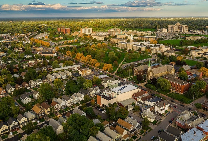

The University Heights neighborhood is both the northern anchor of Buffalo's Metro Rail system and home to UB's South Campus, whose presence creates a unique cultural and demographic dynamic. Photo by Douglas Levere
Building on a 50-year legacy of community-engaged teaching and research, the School of Architecture and Planning is taking an intentional approach to study its campus home and the surrounding University Heights neighborhood over a continuous, multi-year engagement.
The University Heights initiative includes cross-disciplinary work from both research faculty and students, from an assessment of neighborhood assets to focused studios on transit-oriented development and streetscape improvements. Moving forward, the initiative will build off student and faculty explorations as the school continues to partner with the University Heights community.
Program goals
This effort advances four specific goals that can inspire ideas for future development and investment:
- Build a knowledge base on the neighborhood’s existing conditions, assets and challenges. Assembly of this data driven context will offer partners from the public, private and non-profit sectors neighborhood-specific data that can inform decisions.
- Create visions for the future that can inspire developments to promote the neighborhood’s growth and revitalization.
- Catalyze action by identifying potential projects, programs, or infrastructure investments capable of spurring additional investment in the residential and commercial areas throughout the neighborhood.
- Develop a series of tools that can assist local community groups, planners, and potential investors to implement revitalization strategies for the neighborhood.
Through the 2017-2018 academic year, students, faculty, and professional research staff worked hands-on in the University Heights neighborhood, looking at key sites and issues, to identify potential design and planning solutions. Highlights include two master’s level studio courses, a graduate-level urban design seminar, several undergraduate and graduate level course projects, and a baseline assessment of the University Heights neighborhood conducted by the research staff at the UB Regional Institute that frames the neighborhood in data and past and ongoing planning work.


